


Voting Districts not defined, Manistee County, Michigan
About
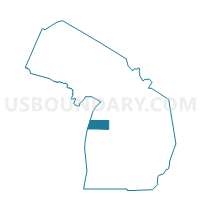
Outline

Summary
| Unique Area Identifier | 598155 |
| Name | Voting Districts not defined |
| County | Manistee County |
| State | Michigan |
| Area (square miles) | 721.35 |
| Land Area (square miles) | 0.00 |
| Water Area (square miles) | 721.35 |
| % of Land Area | 0.00 |
| % of Water Area | 100.00 |
| Latitude of the Internal Point | 44.35025460 |
| Longtitude of the Internal Point | -86.60201200 |
Maps


Graphs
Select a template below for downloading or customizing gragh for Voting Districts not defined, Manistee County, Michigan


Neighbors
Neighoring Voting District (by Name) Neighboring Voting District on the Map
- Voting District 0190884000001, Benzie County, MI
- Voting District 1010332000001, Manistee County, MI
- Voting District 1012804000001, Manistee County, MI
- Voting District 1015072000001, Manistee County, MI
- Voting District 1015072000002, Manistee County, MI
- Voting District 1015072000003, Manistee County, MI
- Voting District 1015074000001, Manistee County, MI
- Voting District 1016076000001, Manistee County, MI
- Voting District 1053432000001, Mason County, MI
- CATO - T 9999 Voting District, Manitowoc County, WI
- WATER Voting District, Kewaunee County, WI
- Voting Districts not defined, Benzie County, MI
- Voting Districts not defined, Mason County, MI
Top 10 Neighboring County Subdivision (by Population) Neighboring County Subdivision on the Map
- Manistee city, Manistee County, MI (6,226)
- Manistee township, Manistee County, MI (4,084)
- Filer charter township, Manistee County, MI (2,325)
- Onekama township, Manistee County, MI (1,329)
- Grant township, Mason County, MI (909)
- Arcadia township, Manistee County, MI (639)
- Blaine township, Benzie County, MI (551)
- County subdivisions not defined, Benzie County, MI (0)
- County subdivisions not defined, Mason County, MI (0)
- County subdivisions not defined, Manistee County, MI (0)
Top 10 Neighboring Place (by Population) Neighboring Place on the Map
Top 10 Neighboring Unified School District (by Population) Neighboring Unified School District on the Map
- Manistee Area Schools, MI (12,921)
- Frankfort-Elberta Area Schools, MI (3,582)
- Onekama Consolidated Schools, MI (3,267)
- School District Not Defined (Water), WI (0)
Top 10 Neighboring State Legislative District Lower Chamber (by Population) Neighboring State Legislative District Lower Chamber on the Map
- State House District 101, MI (92,671)
- Assembly District 2, WI (61,009)
- Assembly District 1, WI (54,189)
Top 10 Neighboring State Legislative District Upper Chamber (by Population) Neighboring State Legislative District Upper Chamber on the Map
- State Senate District 34, MI (275,923)
- State Senate District 35, MI (261,943)
- State Senate District 1, WI (180,989)
Top 10 Neighboring 111th Congressional District (by Population) Neighboring 111th Congressional District on the Map
Top 10 Neighboring Census Tract (by Population) Neighboring Census Tract on the Map
- Census Tract 7, Manistee County, MI (4,078)
- Census Tract 9502, Mason County, MI (3,601)
- Census Tract 8, Manistee County, MI (3,309)
- Census Tract 5, Benzie County, MI (3,107)
- Census Tract 4, Manistee County, MI (2,337)
- Census Tract 9, Manistee County, MI (2,131)
- Census Tract 3, Manistee County, MI (1,956)
- Census Tract 2, Manistee County, MI (1,933)
- Census Tract 9900, Benzie County, MI (0)
- Census Tract 9900, Kewaunee County, WI (0)